East Face of Robert's Horn

I picked up some tendonitis in my hip mid November and had to keep it close to the car for most of early winter. After a few weeks of PT and confidence in the body improving, along with a weather window and not a lot of lower elevation Utah ice, I convinced Cameron to trek with me up into the Aspen Grove area to climb Robert's Horn.
It hadn't snowed in probably three weeks, and we got a few cold nights up high (really cold actually the two nights before hand, probably single digits F). This seemed like a good idea to get up in the Aspen Grove zone, as it's typically known for massive avalanches mid season. A nice stable snowpack was quite inviting, and the other local ice (at lower elevations) was not in great shape.
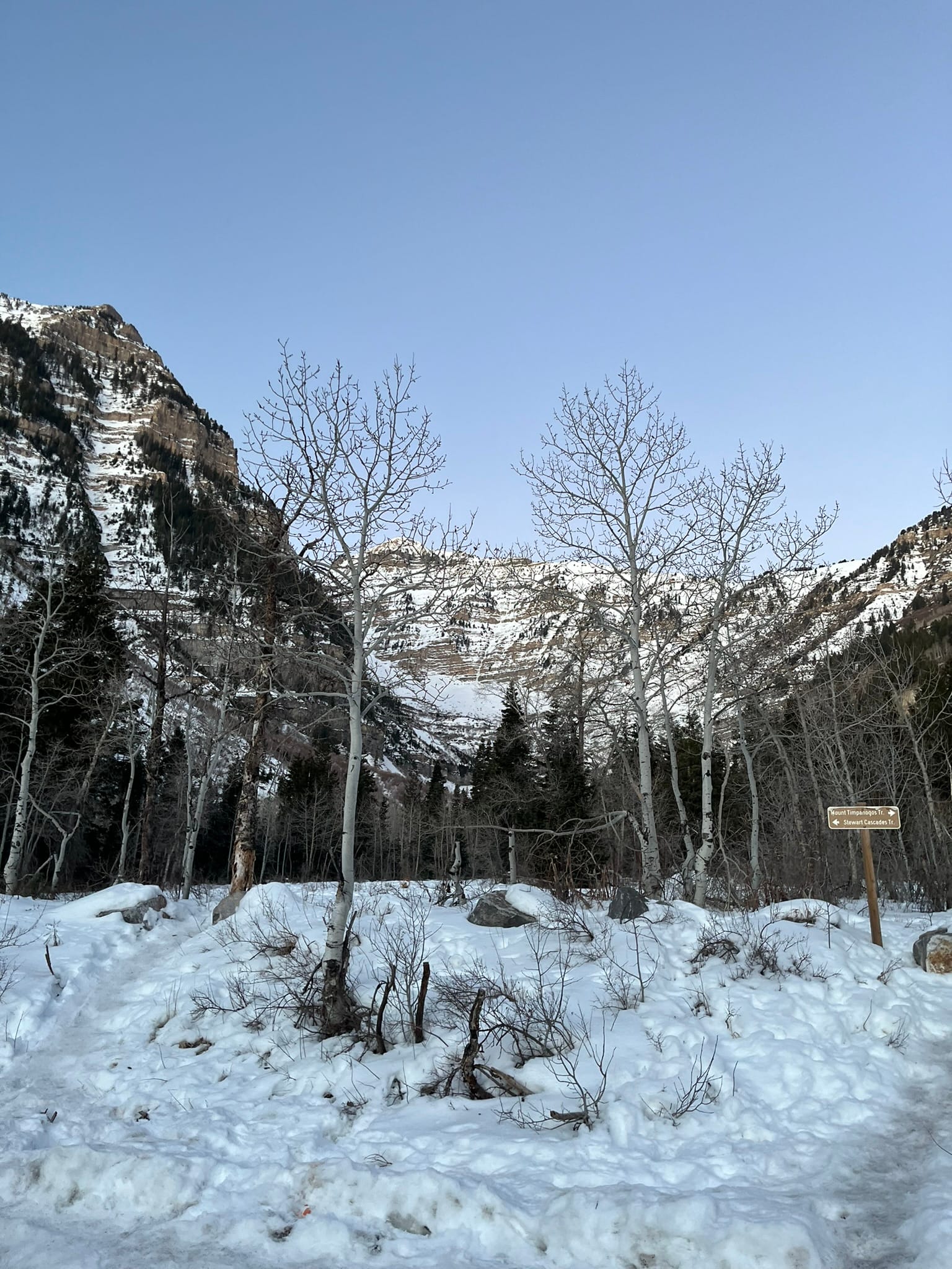
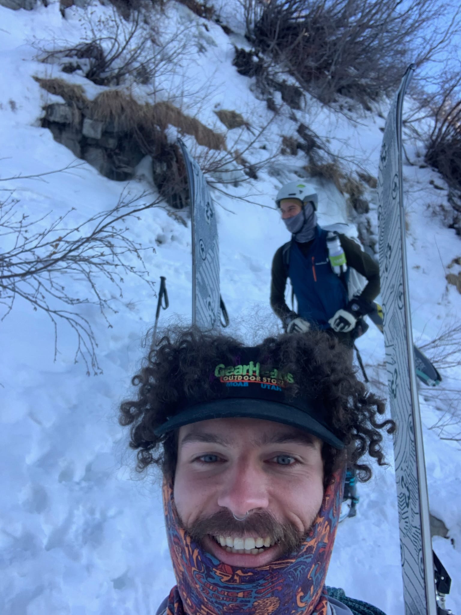
Neither of us had ever been up there before, so we thought skis would be the best bet (we would later regret this choice). We got to the trailhead and started moving at 7:45 and made our way up the lower part pretty quickly.
The trail makes a very wide turn north to avoid some cliff bands, and this was our first time popping off the skis for a short boot. We dutifully followed the trail to find it reached far enough out that it got quite a bit of sun, and we were soon skinning on a very tiny patch of snow, and made our way over a few dirt patches.
We finally hit where the trail finally cut back to the southwest and towards our climb, contouring around several gullies. Here the skin track made some gnarly moves over suddenly exposed terrain, and we popped the skis off again once or twice. At this point we were starting to note that the trail was so well packed we could have gotten by with microspikes to that point. We also noticed a skin track in the valley below us, that looked like someone had come straight up the valley and missing this huge turn the trail had taken us on and noted that we should probably go straight down instead of the way we came up.
The last mile over to the base of the climb dragged on forever and we finally got below the climb. We left the trail where it continues up to Primrose cirque and booted up the last bit of vertical to the base of the ice. Out underneath the route the snow was mostly firm wind slab, but was quite non reactive. By the time we roped up it was past 11 and felt much later than it was due to the sun angle and the way it hid behind the larger mountains to our south.
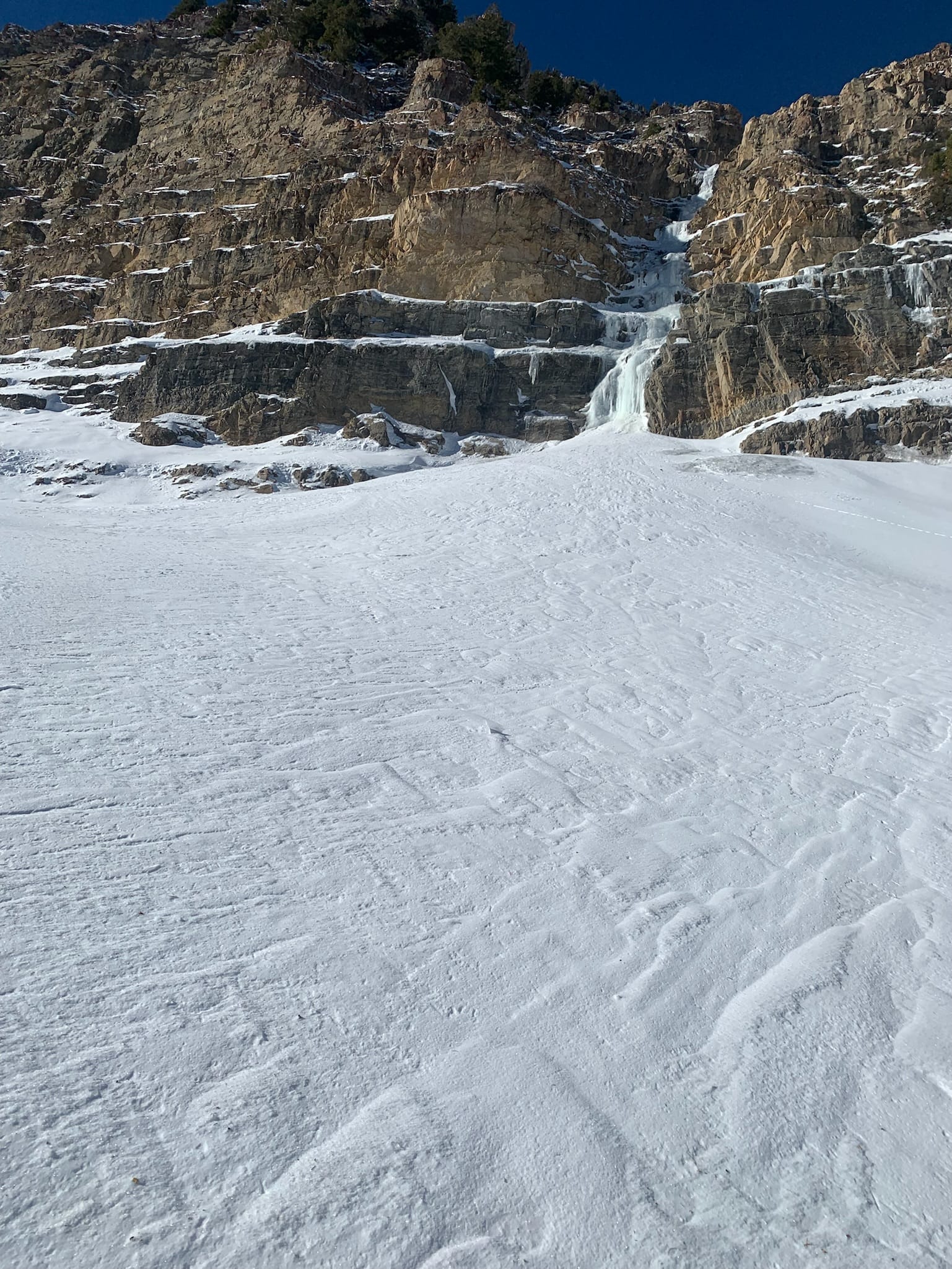
The ice looked appealing and in reasonable shape, but that notion was quickly dispelled after a few swings. There was a little bit of water on some of it, but each swing took out a progressively larger chunk. I got a good stick after a few swings but not without some disconcertingly deeper sounding cracks. I down climbed the first few feet and went up the other side of the formation.
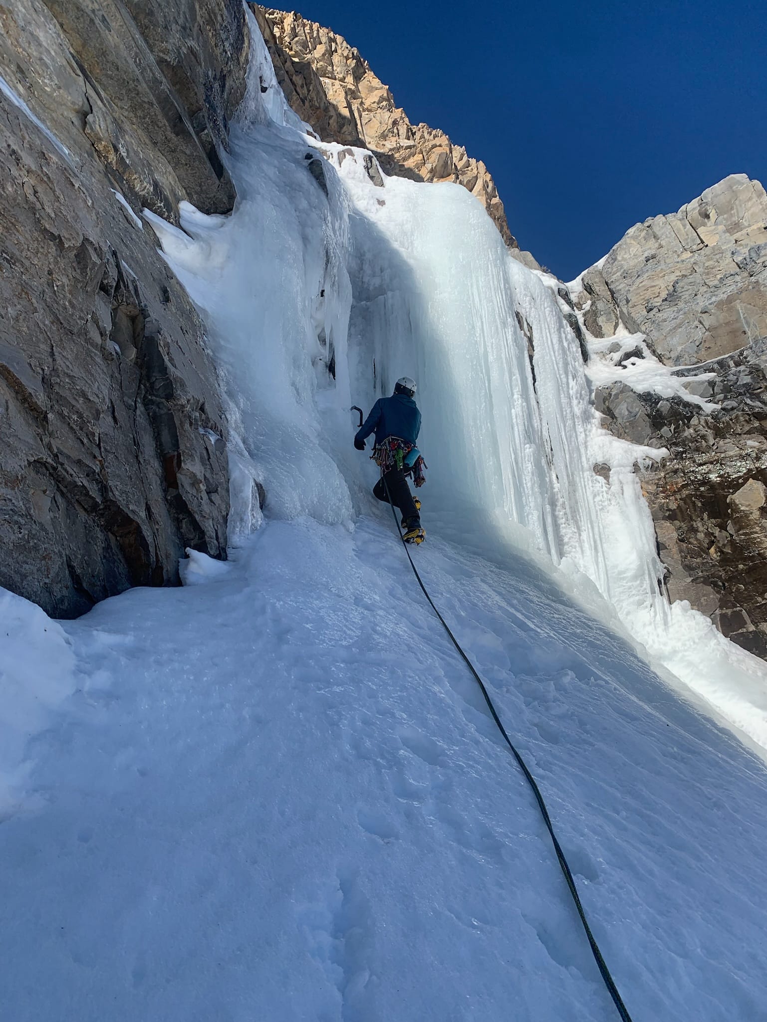
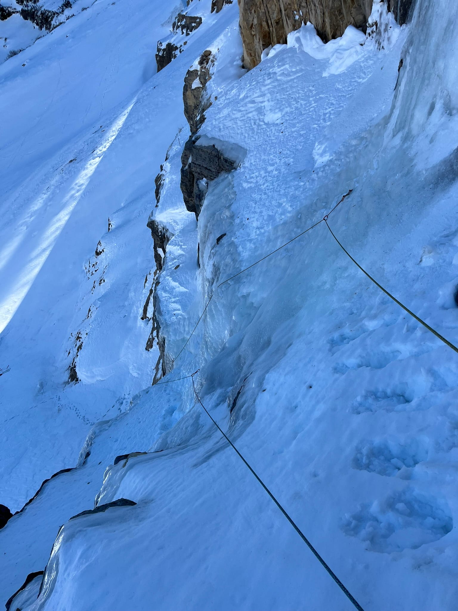
After getting up a pitch the ice wasn't any more confidence inspiring. I stepped off onto a snowy ledge on the right and made an anchor with some nuts and a beak and brought Cameron up. When he got up we discussed the ice quality, time of day, and impending bushwack back to the car and decided to call it. We rapped down off the nuts and made our way back to our skis.
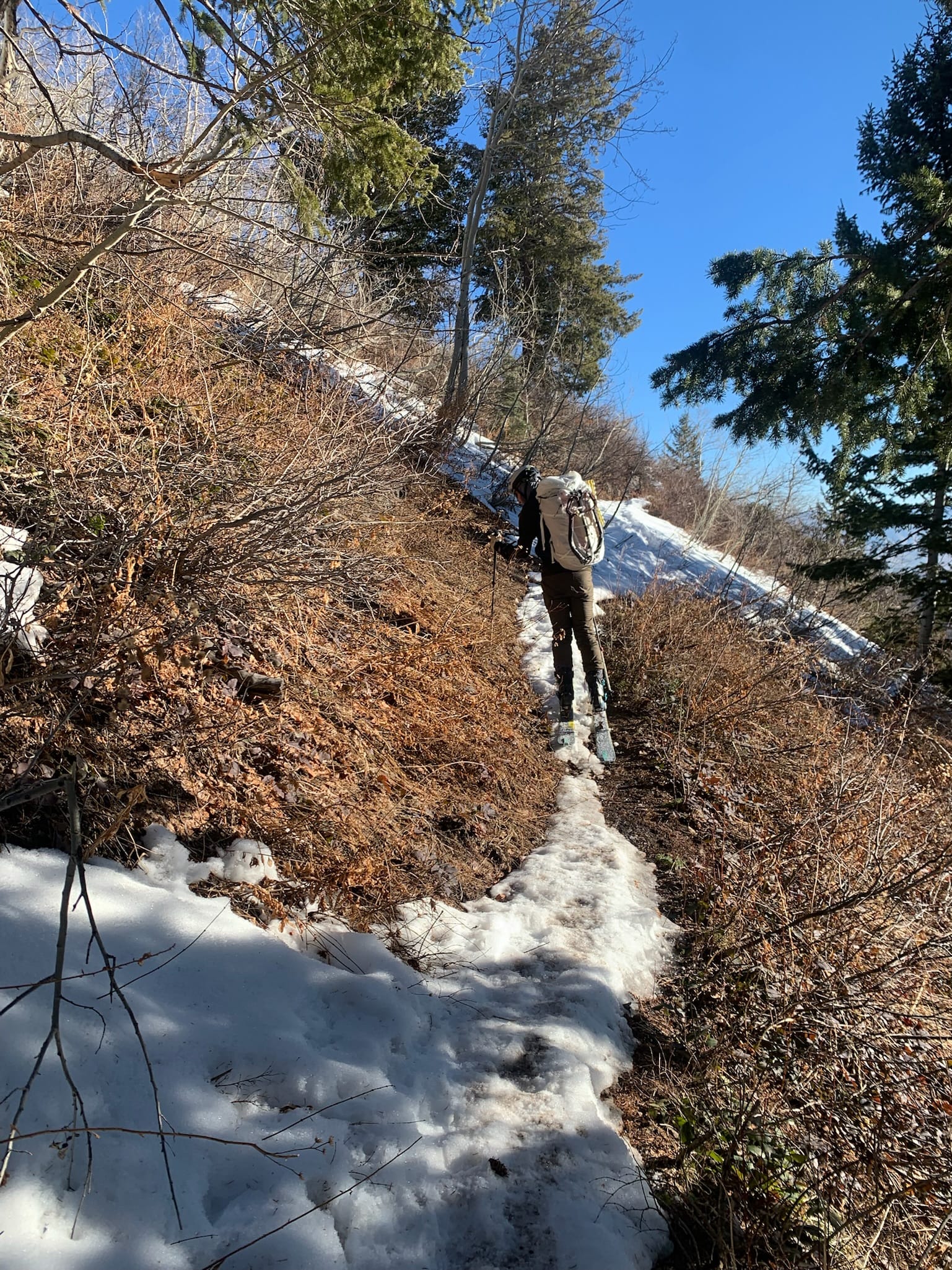
We enjoyed the first few hundred feet of vert down the wind slab getting surprisingly good turns. The wide open slope quickly narrowed and we were navigating increasingly tight bushes. It wasn't long before we had to boot down through a thick brushy slope.
Right before the bushwack begins
We spent a bit of time thrashing our way straight down the gully and around the cliff bands to avoid the long detour north that the trail makes. Eventually we put our skis back on, then took them off again, and finally got the car having decided that hiking would have been much more enjoyable.
Weather and Notes
We had a warm period preceding our climb, followed by 2-3 days of cold with point forecasts showing lows in the single digits F and highs around 25 F just before. The sudden very cold temps probably stressed the ice and caused some of the structural stress that caused our concern while climbing. The snow was nice and crunchy and our boogers frozen at the start so the trailhead temp was likely in the low teens.
We ended up out for 8 hours and 15 minutes round trip.
- ~3h30m to the base of the ice
- ~2h30m skiing and hiking down after rappelling